What else would you do on a free weekend with fine weather? Drag your friend out on a ‘little’ walk!
I walk all the time (because I love to and also because I have a spaniel that *needs* to) and Dave has been wanting to get out of the house more, so as soon as we had a weekend when we were both free set a plan to get out and about. Rather than go to my normal haunts I decided to take him further afield to see the wonderful county he now lives in and so chose a walk which I’d seen @samrculley post about – Three Shires Head. I plugged in the start location to google maps and off we went! What could go wrong?
Saturday: Three Shires Head
Well, in hindsight, I could have looked at the route more thoroughly, and I could have ensured the snap shot I took of it from my iPad had uploaded to the cloud and down again to my phone, but who was to guess that I wouldn’t have reception and my memory would be so bad? (rhetorical – do not answer). Packing a small snack would have also been lovely.
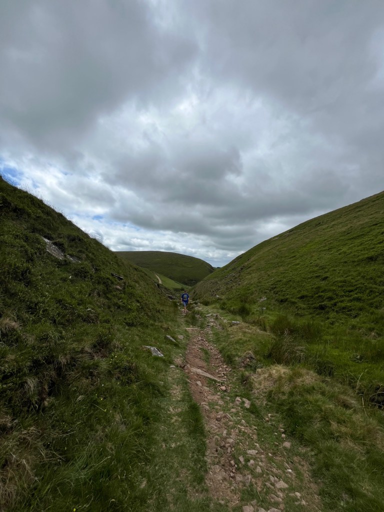
We drove to the start point: Clough House which has a small free car park (very unusual and much appreciated) and without much further thought we were off. It was cloudy but warm, and it starts with gentle rise up a wooded ravine called The Cumberland Brook and it was at the top of this first rise we can across our first choice. Left up a narrower gully leading into the hills, or right, following a more established path. I had no idea, so out with the phone to have a look at the map I took a snapshot of. Oops, it hadnt downloaded and we had no reception. Guess time!
I chose poorly, but only that I didn’t take the right path. We just set off unknowing we were going wrong but all was well and the day was fine. Here is a picture of Dave following me up and just behind him you can see the path that we should have taken. Boring!
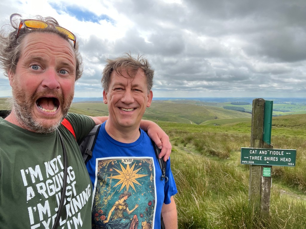
we climbed up, and up, and up and the sweat did pour from our brows, but eventually (15 minutes?) we got to a place were the phone picked up a signal and I could take a look at where we were. We stopped for a quick selfie:
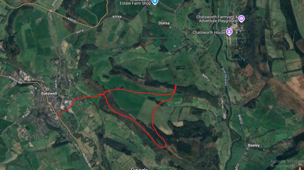
Luckily, we picked up a path that would get us back onto the right track, albeit on a slightly longer route. The plan had been around 4 mild miles however what we actually did was around 6 slightly hillier miles. Here is what that looks like:

We walked along, regaling each other with songs, poetry, and tales of romance and heroics (actually none of these, but we did have a good chat) and before we knew it we were back on plan walking along the river Dane with Bonnie in the lead as always, dipping in and out of the river to cool herself down.

Once we got back to the car we headed towards home but stopped at a local dairy for some wonderful ice cream – alas no photos available as it was melting so fast! Once I got home I had a look at the distances we had covered, and we had planned for around 4 miles, but ended up around 6, which I didn’t think was too bad at all.
Sunday: A stroll to a view point of Chatsworth
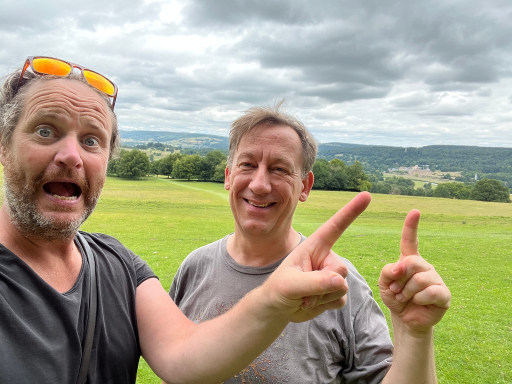
On Sunday I thought we could walk out of Bakewell into the Manners Wood and from there, pop over to a view point in the hills in front of Chatsworth House and then stroll back. It all looked pretty simple on the map, and although I hadn’t walked this exact route before, I had done parts of it on other longer walks. It starts with one big hill, then is mostly flat across to Chatsworth and back and then the last part is all downhill. How hard could it be? It turns out, it was very hot. Which made it a little harder. And I’ll admit, it turned out a little longer than I thought! We wanted to keep it under 4 (about what we had planned for Saturday). It came in around 8.
This is what it looks like on the map: simples.
hahahahhahahahaha. My bad. This is what we looked like when we got to the view point. Hot. Damn Hot.
Bonnie also feeling very hot and very much wanting more of the snacks I brought for her.

On the way back. Dave getting hotter, running low on water, getting ready to kill me if I said ‘we’re nearly there’ one more time.

By the time we got back to back, even Bonnie was tired. We had thought to go to a pub for a drink, but all we managed was a Pepsi max from co-op and collapsing by the river to recover. I even offered to walk back to Dave’s to pick up the car and come and collect Dave and Bonnie, but after 10 minutes he rallied and we made it home.
Lessons learnt:
Dave shall not trust my ‘little walk’ again.
I need to take some human snacks (this is not the first time this has occurred to me)
Ensure the map/route has downloaded
Try and work out the distance BEFORE the walk, not afterwards! (not sure I will ever do this though).
